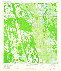
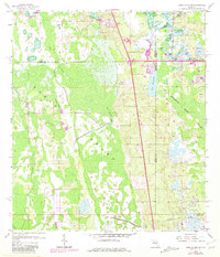
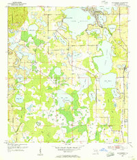
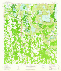
1959 Map of Lake Louisa SW
USGS Topo · Published 1960About this map
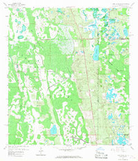
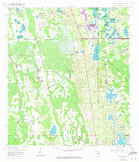
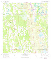
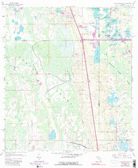
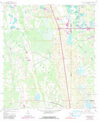
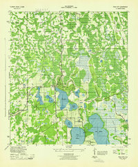
The Green Swamp dominates this central Florida landscape, where the headwaters of several major watersheds converge across Lake, Polk, Orange, and Osceola counties. This late 1950s survey documents a wilderness of cypress strands and wet prairies before the extensive development of the Orlando-Kissimmee area. The hydrography is particularly complex, featuring a dense cluster of water bodies including Lake Gifford, Lake Austin, and Lake Davenport, many of which are interconnected by sluggish channels like Davenport Creek. Evidence of early 20th-century industry and transit is visible in the form of the Old Tram Road, which snakes through the marshes, likely a remnant of the region's logging era. Isolated high ground such as Oak Island and Fishers Island stand out as distinct landmarks within the Green Swamp, while the southern reaches are bisected by Dean Still Road and a major utility pipeline, signaling the encroachment of infrastructure into the wetlands.
Find a feature on this map
29 named features on this map. Tap any name to fly to it.
Don’t see what you’re looking for? This feature index may not catch every label — zoom into the map to look around manually.
Map Details
Editions of this 1959 Lake Louisa SW Map
7 editions found
Other maps of this area
1944 · Polk City
USGS Topo · 1:31,680
1953 · Windermere
USGS Topo · 1:24,000
1953 · Intercession City
USGS Topo · 1:24,000
1953 · Davenport
USGS Topo · 1:24,000

1955 · Orlando
USGS Topo · 1:250,000

1957 · Orlando
USGS Topo · 1:250,000

1958 · Orlando
USGS Topo · 1:250,000
1959 · Gum Lake
USGS Topo · 1:24,000
1959 · Lake Nellie
USGS Topo · 1:24,000
1959 · Lake Louisa
USGS Topo · 1:24,000