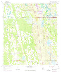
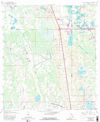
1959 Map of Lake Louisa SW
USGS Topo · Published 1976About this map
The Green Swamp dominates this landscape at the intersection of Lake, Polk, Orange, and Osceola Counties, revealing a complex hydrological network before significant modern development altered the region. A dense cluster of water bodies including Lake Oliver, Lake Gifford, and Lake Austin sits at the northeastern corner, transitioning into the sprawling Davenport Creek Swamp further south. The 1970 photorevisions highlight emerging infrastructure such as a prominent pipeline and new road construction cutting through the wetlands. Dry ground is a rarity in this era, found only at named elevations like Oak Island and Fishers Island. The map documents the natural drainage patterns of Big Creek and Turkey Creek as they feed into the swampy interior, providing a foundational record of the Central Florida wilderness during a period of transition.
Find a feature on this map
28 named features on this map. Tap any name to fly to it.
Don’t see what you’re looking for? This feature index may not catch every label — zoom into the map to look around manually.
Map Details
Editions of this 1959 Lake Louisa SW Map
7 editions found


Other maps of this area

1944 · Polk City
USGS Topo · 1:31,680

1953 · Windermere
USGS Topo · 1:24,000

1953 · Intercession City
USGS Topo · 1:24,000

1953 · Davenport
USGS Topo · 1:24,000

1955 · Orlando
USGS Topo · 1:250,000

1957 · Orlando
USGS Topo · 1:250,000

1958 · Orlando
USGS Topo · 1:250,000

1959 · Gum Lake
USGS Topo · 1:24,000

1959 · Lake Nellie
USGS Topo · 1:24,000

1959 · Lake Louisa
USGS Topo · 1:24,000