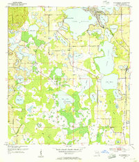
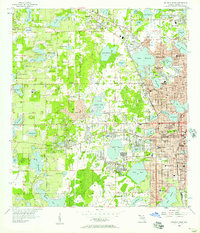
1953 Map of Windermere
USGS Topo · Published 1955About this map
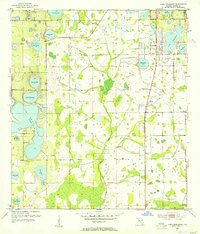
The town of Windermere and its surrounding lakefronts dominate this early 1950s survey of Orange County. The landscape is a labyrinth of freshwater systems, including Lake Butler, Lake Tibet, and Bay Lake, where Riles Island sits isolated. To the east, the Atlantic Coast Line railroad runs past Doctor Phillips and through Vineland, marking the primary transportation artery through this citrus-producing region. Small pockets of development like Summerport Beach are visible, but much of the area remains dominated by wetlands and water bodies such as Reedy Creek and Whittenhorse Creek. This era of Florida history preceded the large-scale resort developments that would later transform this specific geography, capturing the region when it was defined by its orange groves, quiet settlements, and the local industry of a Clay Pit located in the southwest corner of the sheet.
Find a feature on this map
42 named features on this map. Tap any name to fly to it.
Don’t see what you’re looking for? This feature index may not catch every label — zoom into the map to look around manually.
Map Details
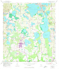
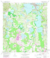
Editions of this 1953 Windermere Map
4 editions found
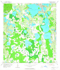
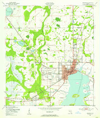
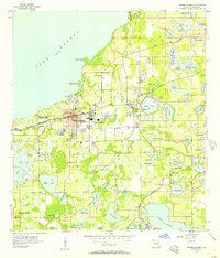
Other maps of this area
1953 · Lake Jessamine
USGS Topo · 1:24,000
1953 · Kissimmee
USGS Topo · 1:24,000
1953 · Intercession City
USGS Topo · 1:24,000

1955 · Orlando
USGS Topo · 1:250,000
1956 · Winter Garden
USGS Topo · 1:24,000
1956 · Orlando West
USGS Topo · 1:24,000

1957 · Orlando
USGS Topo · 1:250,000

1958 · Orlando
USGS Topo · 1:250,000
1959 · Lake Louisa
USGS Topo · 1:24,000
1959 · Lake Louisa SW
USGS Topo · 1:24,000