
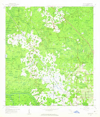
1944 Map of Socrum
USGS Topo · Published 1944About this map
Socrum and its neighboring communities are depicted here during the height of World War II, a period when the Florida interior remained dominated by citrus groves, cypress swamps, and a network of blackwater streams. The landscape is defined by the convergence of Pasco, Hillsborough, and Polk counties, with early infrastructure such as the Atlantic Coast Line railroad and Rock Ridge Road providing the primary transit corridors through the marshy terrain. Significant local landmarks like Bethel Church and the settlement of Millard appear alongside the headwaters of the Hillsborough River.
Find a feature on this map
15 named features on this map. Tap any name to fly to it.
Don’t see what you’re looking for? This feature index may not catch every label — zoom into the map to look around manually.
Map Details
Editions of this 1944 Socrum Map
2 editions found
Other maps of this area

1944 · Plant City
USGS Topo · 1:31,680

1944 · Providence
USGS Topo · 1:31,680

1944 · Lakeland
USGS Topo · 1:31,680

1944 · Antioch
USGS Topo · 1:31,680

1947 · Zephyrhills
USGS Topo · 1:24,000

1955 · Plant City
USGS Topo · 1:250,000

1955 · Orlando
USGS Topo · 1:250,000

1957 · Orlando
USGS Topo · 1:250,000

1958 · Orlando
USGS Topo · 1:250,000

1958 · Plant City
USGS Topo · 1:250,000