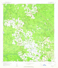
1944 Map of Socrum
USGS Topo · Published 1963About this map
Socrum and the surrounding wetlands of the Blackwater Creek basin define this Central Florida landscape during the mid-1940s. The settlement pattern is concentrated in the southeastern corner of the quadrangle, where the community of Kathleen sits near the Atlantic Coast Line railroad. A notable detail of the era's infrastructure is a secondary rail line marked as Under Construction, cutting diagonally through the marshy terrain toward the northwest. The map captures the social hubs of these rural communities, including the Bethel Ch and the small station at Millard. Large portions of the area remain dominated by cypress heads and swamps, particularly where the borders of Pasco, Polk, and Hillsborough counties meet, illustrating the challenging terrain that dictated early development and transport routes in this region.
Find a feature on this map
10 named features on this map. Tap any name to fly to it.
Don’t see what you’re looking for? This feature index may not catch every label — zoom into the map to look around manually.
Map Details
Editions of this 1944 Socrum Map
2 editions found
Other maps of this area

1944 · Plant City
USGS Topo · 1:31,680

1944 · Providence
USGS Topo · 1:31,680

1944 · Lakeland
USGS Topo · 1:31,680

1944 · Antioch
USGS Topo · 1:31,680

1944 · Socrum
USGS Topo · 1:31,680

1947 · Zephyrhills
USGS Topo · 1:24,000

1955 · Plant City
USGS Topo · 1:250,000

1955 · Orlando
USGS Topo · 1:250,000

1957 · Orlando
USGS Topo · 1:250,000

1958 · Orlando
USGS Topo · 1:250,000