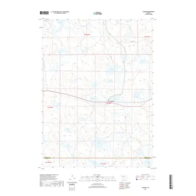
2017 Map of Lakeside
USGS Topo · Published 2017About this map
Lakeside serves as a small anchor for this portion of the Nebraska Sandhills, situated along a primary transit corridor where the landscape is defined by an intricate network of wetland basins. The topography is dominated by numerous named water bodies, ranging from the northern Simondson Lake and Cody Lake down to the southern complex of Patterson Lakes near the Sheridan Co Garden Co boundary. The distribution of these lakes, including Ashburger Lake and Hancock Lake, reflects the unique hydrology of the region, where groundwater and surface depressions create a sanctuary of localized basins.
Find a feature on this map
26 named features on this map. Tap any name to fly to it.
Don’t see what you’re looking for? This feature index may not catch every label — zoom into the map to look around manually.
Map Details
Editions of this 2017 Lakeside Map
This is the sole edition of this map. No revisions or reprints were ever made.
Other maps of this area

1896 · Browns Creek
USGS Topo · 1:125,000

1899 · Browns Creek
USGS Topo · 1:125,000

1948 · Antioch
USGS Topo · 1:62,500

1948 · Lakeside
USGS Topo · 1:62,500

1949 · Mumper
USGS Topo · 1:62,500

1949 · Antioch
USGS Topo · 1:62,500

1950 · Storm Lake
USGS Topo · 1:62,500

1950 · Lakeside
USGS Topo · 1:62,500

1954 · Scottsbluff
USGS Topo · 1:250,000

1955 · Alliance
USGS Topo · 1:250,000