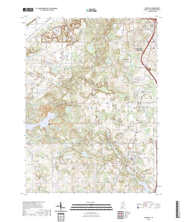
2022 Map of Lakeville
USGS Topo · Published 2022About this map
Potato Creek State Park anchors the southwestern quadrant of this St. Joseph County landscape, where the waters of Worster Lake are surrounded by a network of recreational trails like the Bridle Trails Trl. The geography is defined by a series of glacial lakes and kettle holes, including Wharton Lake, Moon Lake, and Riddles Lake to the south. Historically significant burial sites are scattered throughout the rural townships, from the Sumption Prairie Cem in the north to the Lakeville Cem near the town center.
Find a feature on this map
95 named features on this map. Tap any name to fly to it.
Don’t see what you’re looking for? This feature index may not catch every label — zoom into the map to look around manually.
Map Details
Editions of this 2022 Lakeville Map
This is the sole edition of this map. No revisions or reprints were ever made.
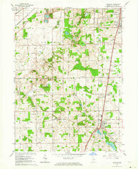
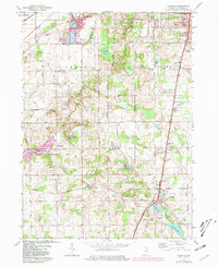
Historical Maps of Pine Station Through Time
3 maps found