
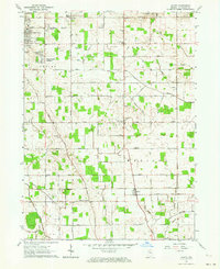
1958 Map of La Paz
USGS Topo · Published 1960About this map
Lapaz serves as the central hub of this northern Indiana landscape in the late 1950s, situated at the intersection of significant transportation corridors including the Blue Star Memorial Highway and the Baltimore and Ohio Road. The area exhibits a dense network of rural roads and family-named landmarks that define the local geography, such as Shively Road and Oliver Heckman Road. The rail infrastructure is particularly prominent, featuring Lapaz Junction where the Pennsylvania Railroad crosses the east-west lines.
Find a feature on this map
83 named features on this map. Tap any name to fly to it.
Don’t see what you’re looking for? This feature index may not catch every label — zoom into the map to look around manually.
Map Details
Editions of this 1958 La Paz Map
This is the sole edition of this map. No revisions or reprints were ever made.
Other maps of this area

1953 · Chicago
USGS Topo · 1:250,000

1957 · Chicago
USGS Topo · 1:250,000

1957 · Inwood
USGS Topo · 1:24,000

1957 · Plymouth
USGS Topo · 1:24,000

1958 · Donaldson
USGS Topo · 1:24,000

1958 · Bremen
USGS Topo · 1:24,000

1958 · Walkerton
USGS Topo · 1:24,000

1958 · North Liberty
USGS Topo · 1:24,000

1958 · Lakeville
USGS Topo · 1:24,000
1961 · Wyatt
USGS Topo · 1:24,000