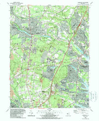
1989 Map of Lakewood
USGS Topo · Published 1989About this map
Lakewood and the surrounding pine barrens region of Ocean, New Jersey are shown during a period of significant suburban expansion in the late 1980s. The landscape is characterized by its numerous water bodies, including Lake Carasaljo and Lake Manetta, which are surrounded by established institutions like Georgian Court College and Paul Kimball Hosp. The map captures the transition from older, concentrated settlements to modern residential developments such as Leisure Village and Holiday City, illustrating the rapid growth occurring along the Garden State Parkway corridor.
Find a feature on this map
90 named features on this map. Tap any name to fly to it.
Don’t see what you’re looking for? This feature index may not catch every label — zoom into the map to look around manually.
Map Details
Editions of this 1989 Lakewood Map
2 editions found
Other maps of this area

1884 · Whitings
USGS Topo · 1:62,500

1888 · Barnegat
USGS Topo · 1:62,500

1888 · Asbury Park
USGS Topo · 1:62,500

1888 · Cassville
USGS Topo · 1:62,500

1888 · Whitings
USGS Topo · 1:62,500

1893 · Asbury Park
USGS Topo · 1:62,500

1893 · Barnegat
USGS Topo · 1:62,500

1894 · Cassville
USGS Topo · 1:62,500

1898 · Barnegat
USGS Topo · 1:62,500

1900 · Cassville
USGS Topo · 1:62,500