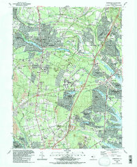
1989 Map of Lakewood
USGS Topo · Published 1989About this map
Lakewood is the primary hub of this landscape, where the waters of Lake Carasaljo and Lake Manetta meet at the Waterworks. The map captures the suburban expansion across Ocean County Park and the development of major educational and religious institutions such as Georgian Court College and Beth Medrash Govoha. Residential growth is evident in the planned layouts of Leisure Village, Holiday City, and Greenbriar, which are situated between the drainage systems of the Metedeconk River and Kettle Creek.
Find a feature on this map
101 named features on this map. Tap any name to fly to it.
Don’t see what you’re looking for? This feature index may not catch every label — zoom into the map to look around manually.
Map Details
Editions of this 1989 Lakewood Map
2 editions found
Other maps of this area

1884 · Whitings
USGS Topo · 1:62,500

1888 · Barnegat
USGS Topo · 1:62,500

1888 · Asbury Park
USGS Topo · 1:62,500

1888 · Cassville
USGS Topo · 1:62,500

1888 · Whitings
USGS Topo · 1:62,500

1893 · Asbury Park
USGS Topo · 1:62,500

1893 · Barnegat
USGS Topo · 1:62,500

1894 · Cassville
USGS Topo · 1:62,500

1898 · Barnegat
USGS Topo · 1:62,500

1900 · Cassville
USGS Topo · 1:62,500