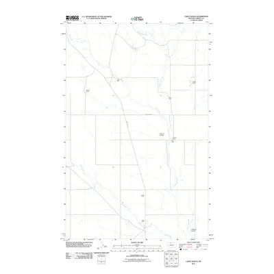
2011 Map of Lakey Ranch
USGS Topo · Published 2011About this map
Lakey Ranch and a network of widely spaced family holdings define this portion of Liberty County, Montana. The landscape is structured by the drainage patterns of Government Creek and Corral Creek, which cut through the high plains. This 2011 survey captures the distribution of legacy ranching operations, including Hawks Ranch and Reiland Ranch, during an era of modern land management. Movement through the area is anchored by Whitlash Rd and Horse Creek Rd, while the local topography is punctuated by distinct features like Bourne Coulee and Phillipine Coulee. The map provides a precise record of rural property names and water sources like Cottonwood Creek and Horse Creek, essential for understanding the agricultural footprint and genealogy of this Northern Montana ranching community.
Find a feature on this map
16 named features on this map. Tap any name to fly to it.
Don’t see what you’re looking for? This feature index may not catch every label — zoom into the map to look around manually.
Map Details
Editions of this 2011 Lakey Ranch Map
This is the sole edition of this map. No revisions or reprints were ever made.
Other maps of this area

1919 · Alma
USGS Topo · 1:125,000

1954 · Shelby
USGS Topo · 1:250,000

1958 · Shelby
USGS Topo · 1:250,000

1962 · Tiber
USGS Topo · 1:24,000

1962 · Lakey Ranch
USGS Topo · 1:24,000

1962 · North Lothair School
USGS Topo · 1:24,000

1962 · Blair Ranch
USGS Topo · 1:24,000

1962 · Haystack Butte
USGS Topo · 1:24,000

1962 · Mount Lebanon
USGS Topo · 1:24,000

1963 · Vaver Reservoir
USGS Topo · 1:24,000