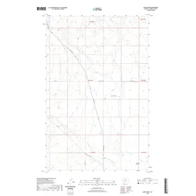
2020 Map of Lakey Ranch
USGS Topo · Published 2020About this map
Lakey Ranch anchors this high-plains landscape in northern Montana, where the terrain is defined by deep coulees and seasonal watercourses. The transportation network reflects the region’s long-standing reliance on cattle ranching and hauling, marked by the presence of Old Whitlash Freight Rd and Freight Rd. These routes cut through a rolling landscape drained by Government Cr, Corral Cr, and Horse Cr, illustrating how early ranching operations were tied to the natural hydrology of the Missouri River basin. Broad depressions like Bourne Coulee and Phillipine Coulee reveal the geological character of Liberty County, providing natural shelter and grazing corridors for the scattered ranching homesteads. The map traces modern access through Whitlash Rd while preserving the alignment of historic freighting corridors that once connected these northern Montana rangelands.
Find a feature on this map
21 named features on this map. Tap any name to fly to it.
Don’t see what you’re looking for? This feature index may not catch every label — zoom into the map to look around manually.
Map Details
Editions of this 2020 Lakey Ranch Map
This is the sole edition of this map. No revisions or reprints were ever made.
Other maps of this area

1919 · Alma
USGS Topo · 1:125,000

1954 · Shelby
USGS Topo · 1:250,000

1958 · Shelby
USGS Topo · 1:250,000

1962 · Tiber
USGS Topo · 1:24,000

1962 · Lakey Ranch
USGS Topo · 1:24,000

1962 · North Lothair School
USGS Topo · 1:24,000

1962 · Blair Ranch
USGS Topo · 1:24,000

1962 · Haystack Butte
USGS Topo · 1:24,000

1962 · Mount Lebanon
USGS Topo · 1:24,000

1963 · Vaver Reservoir
USGS Topo · 1:24,000