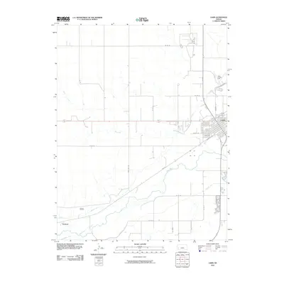
2010 Map of Lakin
USGS Topo · Published 2010About this map
Lakin serves as the primary hub of activity in this western Kansas landscape, defined by its proximity to the Arkansas River. The town's grid expands north of the river, while the surrounding plains are etched with an intricate irrigation system including the Amazon Ditch and the Southside Ditch. These waterways reflect the agricultural necessity of moving water through Kearny County's arid climate. To the west, the settlement of Hartland and the Hartland Cemetery provide critical anchor points for genealogists and local historians, marking a community site that stands apart from the main population center. The presence of Lakin Landing Field north of town and roads such as Three Mile Rd and Rive Rd show the area's modern connectivity, even as it maintains its traditional reliance on the river and its seasonal tributaries like Sand Creek.
Find a feature on this map
26 named features on this map. Tap any name to fly to it.
Don’t see what you’re looking for? This feature index may not catch every label — zoom into the map to look around manually.
Map Details
Editions of this 2010 Lakin Map
This is the sole edition of this map. No revisions or reprints were ever made.
Other maps of this area

1891 · Larned
USGS Topo · 1:125,000

1900 · Lakin
USGS Topo · 1:125,000

1955 · Dodge City
USGS Topo · 1:250,000

1955 · Scott City
USGS Topo · 1:250,000

1958 · Dodge City
USGS Topo · 1:250,000

1958 · Scott City
USGS Topo · 1:250,000

1959 · Dodge City
USGS Topo · 1:250,000
1960 · Deerfield SW
USGS Topo · 1:24,000

1960 · Deerfield
USGS Topo · 1:24,000
1966 · Lakin SE
USGS Topo · 1:24,000