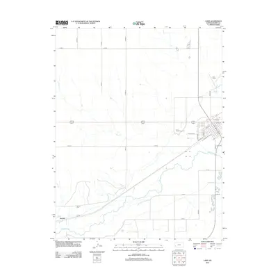
2012 Map of Lakin
USGS Topo · Published 2012About this map
The Arkansas River and its accompanying irrigation infrastructure define this landscape in western Kansas. The Amazon Ditch and Southside Ditch are prominent features, reflecting the critical role of water management in the region's agricultural development. The settlement of Hartland sits on the northern bank of the river in the southwestern corner of the quadrangle, with the nearby Hartland Cem serving as a primary point of interest for genealogists.
Find a feature on this map
38 named features on this map. Tap any name to fly to it.
Don’t see what you’re looking for? This feature index may not catch every label — zoom into the map to look around manually.
Map Details
Editions of this 2012 Lakin Map
This is the sole edition of this map. No revisions or reprints were ever made.
Other maps of this area

1891 · Larned
USGS Topo · 1:125,000

1900 · Lakin
USGS Topo · 1:125,000

1955 · Dodge City
USGS Topo · 1:250,000

1955 · Scott City
USGS Topo · 1:250,000

1958 · Dodge City
USGS Topo · 1:250,000

1958 · Scott City
USGS Topo · 1:250,000

1959 · Dodge City
USGS Topo · 1:250,000
1960 · Deerfield SW
USGS Topo · 1:24,000

1960 · Deerfield
USGS Topo · 1:24,000
1966 · Lakin SE
USGS Topo · 1:24,000