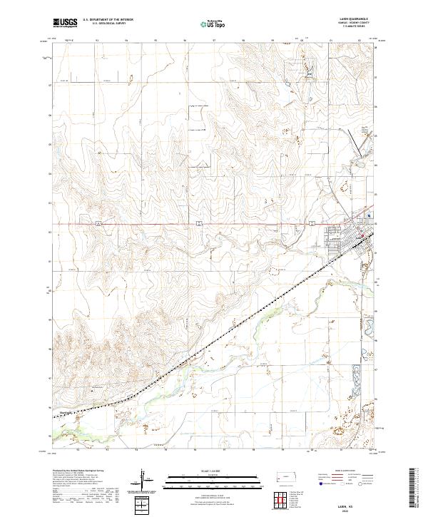
2022 Map of Lakin
USGS Topo · Published 2022About this map
The Arkansas River corridor defines the geography of this modern survey, cutting through Kearny County where intensive irrigation networks like the Amazon Ditch and Southside Ditch support the regional agriculture. The city of Lakin serves as the primary hub, showing a structured grid of streets including Kendall Ave and Santa Fe Ave, while the smaller settlement of Hartland sits further west along the river. These locations trace their origins to the westward expansion and the legacy of the Santa Fe Trail, a heritage visible in the naming of W Railroad Ave. Local history is anchored by the Hartland Cem, providing a fixed point for genealogical research in an area otherwise dominated by the shifting sands and seasonal flows of Sand Cr and the waters of Clear Lake.
Find a feature on this map
42 named features on this map. Tap any name to fly to it.
Don’t see what you’re looking for? This feature index may not catch every label — zoom into the map to look around manually.
Map Details
Editions of this 2022 Lakin Map
This is the sole edition of this map. No revisions or reprints were ever made.
Other maps of this area

1891 · Larned
USGS Topo · 1:125,000

1900 · Lakin
USGS Topo · 1:125,000

1955 · Dodge City
USGS Topo · 1:250,000

1955 · Scott City
USGS Topo · 1:250,000

1958 · Dodge City
USGS Topo · 1:250,000

1958 · Scott City
USGS Topo · 1:250,000

1959 · Dodge City
USGS Topo · 1:250,000
1960 · Deerfield SW
USGS Topo · 1:24,000

1960 · Deerfield
USGS Topo · 1:24,000
1966 · Lakin SE
USGS Topo · 1:24,000