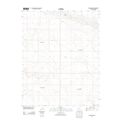
2013 Map of Lambing Spring
USGS Topo · Published 2013About this map
Mestas Cem sits in the southeastern reaches of this Las Animas County landscape, a quiet marker of local history in a terrain defined by drainage patterns and ridgelines. The area is characterized by the carving flow of Van Bremer Arroyo to the north and Luning Arroyo through the center, both leading toward the eponymous Lambing Spring. This 2013 survey illustrates the remote character of the Colorado high plains, where human footprints are limited to scattered county roads like Co RD-54 and Co RD-48. The prominent topographical feature of The Hogback rises in the northeast, providing a natural anchor for the surrounding rangeland. The map detail reflects a persistent agricultural and ranching landscape where water sources and family landmarks remain the primary points of orientation.
Find a feature on this map
11 named features on this map. Tap any name to fly to it.
Don’t see what you’re looking for? This feature index may not catch every label — zoom into the map to look around manually.
Map Details
Editions of this 2013 Lambing Spring Map
This is the sole edition of this map. No revisions or reprints were ever made.
Other maps of this area

1891 · Mesa De Maya
USGS Topo · 1:125,000

1892 · Elmoro
USGS Topo · 1:125,000

1893 · Elmoro
USGS Topo · 1:125,000

1893 · Mesa de Maya
USGS Topo · 1:125,000

1897 · Elmoro
USGS Topo · 1:125,000

1954 · Trinidad
USGS Topo · 1:250,000

1955 · La Junta
USGS Topo · 1:250,000

1955 · Trinidad
USGS Topo · 1:250,000

1958 · La Junta
USGS Topo · 1:250,000

1958 · Trinidad
USGS Topo · 1:250,000