
2014 Map of Lamerdorf Peak NW
USGS Topo · Published 2014About this map
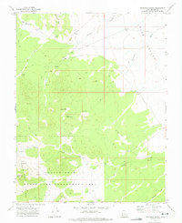
Pine Valley in Beaver County is defined by an intricate network of water management features and drainage systems. The landscape is marked by several key reservoirs, including Central Pine Reservoir, Chamisa Reservoir, and the CCC Reservoir, the latter likely reflecting the legacy of the Civilian Conservation Corps. These catchments are connected by seasonal washes such as Jackson Wash, Turkey Wash, and Antelope Wash, which illustrate the arid climate's reliance on intermittent water flow. To the east, the Blackburn Ditch serves as a primary irrigation or drainage feature. Human activity in this portion of the Great Basin is further evidenced by a sparse road network, primarily Pine Valley Rd and Vance Spring Rd, which provide access through the vast public lands and surveyed townships of this high-desert environment.
Find a feature on this map
19 named features on this map. Tap any name to fly to it.
Don’t see what you’re looking for? This feature index may not catch every label — zoom into the map to look around manually.
Map Details
Editions of this 2014 Lamerdorf Peak NW Map
This is the sole edition of this map. No revisions or reprints were ever made.
Other maps of this area

1953 · Richfield
USGS Topo · 1:250,000

1958 · Richfield
USGS Topo · 1:250,000

1960 · Wah Wah Summit
USGS Topo · 1:62,500

1971 · Pine Grove Reservoir
USGS Topo · 1:24,000

1971 · Sewing Machine Pass
USGS Topo · 1:24,000

1971 · Halfway Summit
USGS Topo · 1:24,000

1971 · Sawtooth Peak
USGS Topo · 1:24,000

1971 · Lamerdorf Peak NW
USGS Topo · 1:24,000

1971 · Lamerdorf Peak
USGS Topo · 1:24,000
1972 · Buckhorn Spring
USGS Topo · 1:24,000