
1960 Map of Wah Wah Summit
USGS Topo · Published 1962About this map
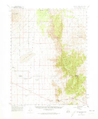
The Desert Experimental Range dominates the western half of this landscape, reflecting federal efforts to manage arid ecosystems during the mid-20th century. Within this dedicated research area, detailed Experimental Plot markers and the Range Headquarters illustrate the scientific infrastructure established to study the harsh Utah interior. To the east, the Wah Wah Mountains rise sharply, providing a topographic barrier punctuated by gaps like Middle Pass and Upper Pass. The isolation of the region is evident in the sparse human markers, limited mostly to family-named landmarks like Kelleys Place and water management features such as Desert Ranch Reservoir and the Cow Camp Well. The presence of the Pine Valley Hardpan and numerous seasonal reservoirs underscores the critical importance of water rights and ranching infrastructure on the Millard and Beaver County line.
Find a feature on this map
31 named features on this map. Tap any name to fly to it.
Don’t see what you’re looking for? This feature index may not catch every label — zoom into the map to look around manually.
Map Details
Editions of this 1960 Wah Wah Summit Map
2 editions found
Other maps of this area

1953 · Richfield
USGS Topo · 1:250,000

1958 · Richfield
USGS Topo · 1:250,000

1959 · Frisco
USGS Topo · 1:62,500

1960 · Burbank Hills
USGS Topo · 1:62,500

1960 · Frisco Peak
USGS Topo · 1:62,500

1960 · Crystal Peak
USGS Topo · 1:62,500

1960 · The Barn
USGS Topo · 1:62,500

1971 · Sewing Machine Pass
USGS Topo · 1:24,000

1971 · Halfway Summit
USGS Topo · 1:24,000

1971 · Tunnel Spring
USGS Topo · 1:24,000