
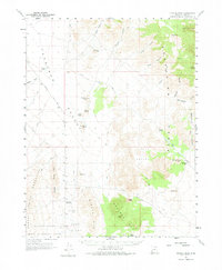
1960 Map of Crystal Peak
USGS Topo · Published 1962About this map
Crystal Peak stands as a prominent landmark in this high-desert landscape of Millard County, Utah, where the topography transition from the Little Rough Range toward the southern end of the Snake Range. The map documents a rugged network of waterless drainage systems such as Deadman Wash and canyon-cut terrain including Cedar Canyon and Burnout Canyon. Man-made infrastructure is sparse, defined primarily by the Garrison Black Rock Road and various jeep trails that navigate the gaps between formations like Pyramid Knoll and Shotgun Knoll. The presence of the Desert Experimental Range at the southern boundary highlights the area's use for ecological study. Notable water catchment points, essential in this arid environment, include Pine Pass Reservoir and the uniquely named Painted Potholes, which alongside Probst Pond, represent the few dependable water features in this expansive basin-and-range territory.
Find a feature on this map
50 named features on this map. Tap any name to fly to it.
Don’t see what you’re looking for? This feature index may not catch every label — zoom into the map to look around manually.
Map Details
Editions of this 1960 Crystal Peak Map
2 editions found
Other maps of this area

1908 · Fish Springs
USGS Topo · 1:250,000

1910 · Fish Springs
USGS Topo · 1:250,000

1953 · Richfield
USGS Topo · 1:250,000

1953 · Delta
USGS Topo · 1:250,000

1958 · Richfield
USGS Topo · 1:250,000

1958 · Delta
USGS Topo · 1:250,000

1960 · Notch Peak
USGS Topo · 1:62,500

1960 · Conger Range
USGS Topo · 1:62,500

1960 · Burbank Hills
USGS Topo · 1:62,500

1960 · Frisco Peak
USGS Topo · 1:62,500