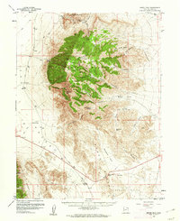
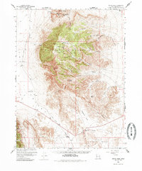
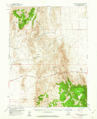
1960 Map of Notch Peak
USGS Topo · Published 1961About this map
Notch Peak dominates the high limestone cliffs of the Sawtooth Mountains, a striking vertical landscape within the House Range of Millard County. This 1960 survey documents a transition from the stark flats of the Tule Valley to the high-elevation mining and grazing districts. Prospectors and geologists can identify historical extraction sites such as the Brown Queen Mine, the Klondike Mine, and various Placer Mines located near the Amasa Valley.
Find a feature on this map
43 named features on this map. Tap any name to fly to it.
Don’t see what you’re looking for? This feature index may not catch every label — zoom into the map to look around manually.
Map Details
Editions of this 1960 Notch Peak Map
2 editions found
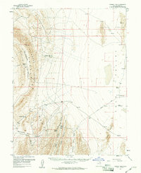
Other maps of this area

1908 · Fish Springs
USGS Topo · 1:250,000

1910 · Fish Springs
USGS Topo · 1:250,000

1953 · Richfield
USGS Topo · 1:250,000

1953 · Delta
USGS Topo · 1:250,000

1958 · Richfield
USGS Topo · 1:250,000

1958 · Delta
USGS Topo · 1:250,000
1959 · Cowboy Pass
USGS Topo · 1:62,500
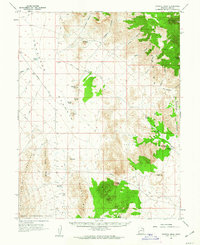
1960 · Crystal Peak
USGS Topo · 1:62,500
1960 · Conger Mountain
USGS Topo · 1:62,500
1960 · The Barn
USGS Topo · 1:62,500