
1971 Map of Tunnel Spring
USGS Topo · Published 1974About this map
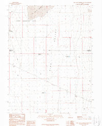
The Desert Experimental Range dominates this 1970s landscape in Millard County, representing a significant scientific effort to study arid land ecology. This high-desert environment is defined by the sharp transition between the Antelope Valley to the west and the Tunnel Spring Mountains and Pine Valley to the east. Several designated Experimental Plot locations and larger Experimental Plots are scattered across the terrain, indicating the systematic research being conducted on the local flora and soil.
Find a feature on this map
17 named features on this map. Tap any name to fly to it.
Don’t see what you’re looking for? This feature index may not catch every label — zoom into the map to look around manually.
Map Details
Editions of this 1971 Tunnel Spring Map
This is the sole edition of this map. No revisions or reprints were ever made.
Other maps of this area

1953 · Richfield
USGS Topo · 1:250,000

1958 · Richfield
USGS Topo · 1:250,000

1960 · Burbank Hills
USGS Topo · 1:62,500

1960 · Wah Wah Summit
USGS Topo · 1:62,500

1960 · Crystal Peak
USGS Topo · 1:62,500

1971 · Mountain Home Pass
USGS Topo · 1:24,000

1971 · Halfway Summit
USGS Topo · 1:24,000

1971 · Mormon Gap
USGS Topo · 1:24,000

1980 · Wah Wah Mts. North
USGS Topo · 1:100,000
1989 · Pine Valley Hardpan South
USGS Topo · 1:24,000