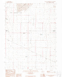
1989 Map of Pine Valley Hardpan South
USGS Topo · Published 1989About this map
The Desert Experimental Range occupies the northern half of this high-desert basin, where federal land management and research took precedence during the late 20th century. Centered around Range Headquarters, the landscape is defined by the massive Pine Valley Hardpan and the Pine Valley Depression, features that indicate the arid, seasonal drainage patterns of this remote region. The map captures a transition across the Millard Co Beaver Co boundary, illustrating a land use geared toward large-scale ranching and ecological study. Human presence is sparse but strategic, marked by a network of water management features such as Desert Ranch Reservoir, Electric Fence Reservoir, and Cow Track Reservoir. These improvements, along with scattered Drill Holes and a Corral, highlight the infrastructure required for sustaining life and livestock in the Great Basin’s challenging environment.
Find a feature on this map
11 named features on this map. Tap any name to fly to it.
Don’t see what you’re looking for? This feature index may not catch every label — zoom into the map to look around manually.
Map Details
Editions of this 1989 Pine Valley Hardpan South Map
This is the sole edition of this map. No revisions or reprints were ever made.
Other maps of this area

1953 · Richfield
USGS Topo · 1:250,000

1958 · Richfield
USGS Topo · 1:250,000

1960 · Wah Wah Summit
USGS Topo · 1:62,500

1971 · Sewing Machine Pass
USGS Topo · 1:24,000

1971 · Halfway Summit
USGS Topo · 1:24,000

1971 · Tunnel Spring
USGS Topo · 1:24,000

1971 · Sawtooth Peak
USGS Topo · 1:24,000

1971 · Lamerdorf Peak NW
USGS Topo · 1:24,000

1980 · Wah Wah Mts. South
USGS Topo · 1:100,000

1980 · Wah Wah Mts. North
USGS Topo · 1:100,000