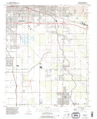
1992 Map of Lamont
USGS Topo · Published 1995About this map
Agricultural development and industrial infrastructure define this landscape southeast of Bakersfield, where a vast network of pipelines and oil fields intersects with the irrigation systems of the Kern Island Canal and East Side Canal. The map reveals a transition from the urban grid of the city, including Union Cemetery and the Bakersfield Municipal Airport, into the specialized settlements of the San Joaquin Valley. These outlying areas include Magunden, Algoso, and Fuller Acres, the latter of which is situated near a prominent Refinery.
Find a feature on this map
50 named features on this map. Tap any name to fly to it.
Don’t see what you’re looking for? This feature index may not catch every label — zoom into the map to look around manually.
Map Details
Editions of this 1992 Lamont Map
This is the sole edition of this map. No revisions or reprints were ever made.
Other maps of this area

1906 · Bakersfield
USGS Topo · 1:62,500

1910 · Buena Vista Lake
USGS Topo · 1:125,000

1912 · Buena Vista Lake
USGS Topo · 1:125,000

1914 · Caliente
USGS Topo · 1:125,000

1929 · Fairfax School
USGS Topo · 1:31,680

1930 · Weed Patch
USGS Topo · 1:31,680

1930 · Arvin
USGS Topo · 1:31,680

1930 · Conner
USGS Topo · 1:31,680

1930 · Oildale
USGS Topo · 1:31,680

1931 · Edison
USGS Topo · 1:31,680