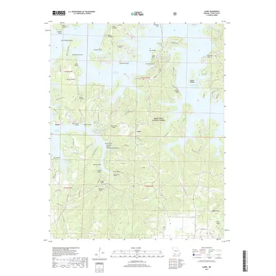
2017 Map of Lampe
USGS Topo · Published 2017About this map
Table Rock Lake dominates this portion of Stone County, where the irregular shoreline of the White River impoundment creates a complex landscape of deep coves and steep bluffs. The settlement of Lampe serves as a central point for the surrounding highlands, while Blue Eye sits to the southeast near the state line. Topographical features like Bread Tray Mtn and Coney Island illustrate the dramatic relief of the Ozark Plateau, much of which is preserved within the Mark Twain National Forest. Local history is anchored by several rural burial grounds including Kimberling Cem and Rice Cem. Transportation across this watery terrain is facilitated by Kimberling Bridge, connecting the peninsulas that characterize this region. The map reveals a mix of recreation and remote homesteads, with named hollows like Stillhouse Hollow and Hoot Owl Hollow suggesting the traditional land-use patterns of the area.
Find a feature on this map
104 named features on this map. Tap any name to fly to it.
Don’t see what you’re looking for? This feature index may not catch every label — zoom into the map to look around manually.
Map Details
Editions of this 2017 Lampe Map
This is the sole edition of this map. No revisions or reprints were ever made.
Other maps of this area

1900 · Eureka Springs
USGS Topo · 1:125,000

1901 · Eureka Springs
USGS Topo · 1:125,000

1904 · Harrison
USGS Topo · 1:125,000

1905 · Harrison
USGS Topo · 1:125,000

1907 · Forsyth
USGS Topo · 1:125,000

1927 · Shell Knob
USGS Topo · 1:62,500

1945 · Harrison
USGS Topo · 1:250,000

1949 · Harrison
USGS Topo · 1:250,000

1950 · Shell Knob
USGS Topo · 1:62,500

1950 · Garber
USGS Topo · 1:24,000