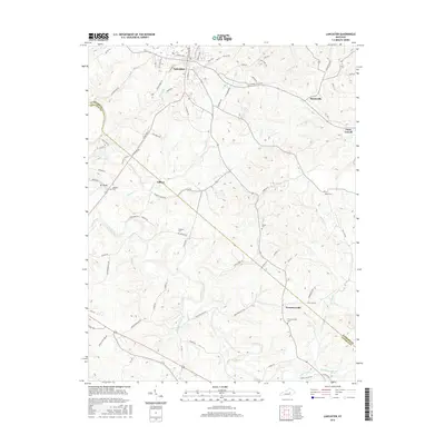
2016 Map of Lancaster
USGS Topo · Published 2016About this map
Lancaster serves as the primary hub in this central Kentucky landscape, situated where the terrain begins to ripple toward the Dix River drainage. The 2016 survey illustrates a regional geometry defined by long-established transit corridors like Stanford Road and Lexington Road branching out from the town center. Outside the municipal limits, the map reveals a traditional settlement pattern of small communities and rural intersections, including Hyattsville, Point Leavell, and Preachersville.
Find a feature on this map
83 named features on this map. Tap any name to fly to it.
Don’t see what you’re looking for? This feature index may not catch every label — zoom into the map to look around manually.
Map Details
Editions of this 2016 Lancaster Map
This is the sole edition of this map. No revisions or reprints were ever made.
Other maps of this area

1892 · Richmond
USGS Topo · 1:125,000

1893 · London
USGS Topo · 1:125,000

1897 · Richmond
USGS Topo · 1:125,000

1897 · London
USGS Topo · 1:125,000

1905 · Harrodsburg
USGS Topo · 1:125,000

1950 · Bryantsville
USGS Topo · 1:24,000

1952 · Halls Gap
USGS Topo · 1:24,000

1952 · Crab Orchard
USGS Topo · 1:24,000

1952 · Buckeye
USGS Topo · 1:24,000

1952 · Paint Lick
USGS Topo · 1:24,000