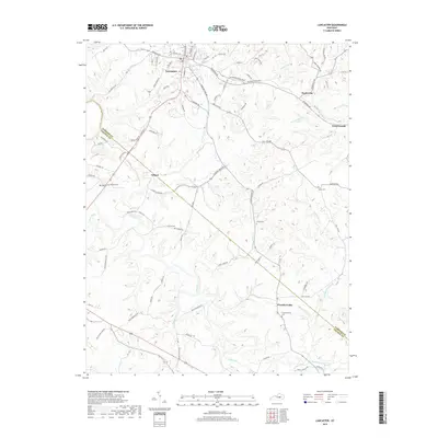
2019 Map of Lancaster
USGS Topo · Published 2019About this map
Lancaster serves as the central hub of this central Kentucky landscape, where the plateau begins to break into the complex drainages of the Dix River. The settlement pattern reflects a long history of ridge-top farming and river-valley crossings, with smaller communities like Hyattsville and Gilbert situated along the primary corridors of Richmond Rd and Stanford Rd. These roads trace the high ground between winding watercourses such as Gilberts Cr and Sugar Cr.
Find a feature on this map
83 named features on this map. Tap any name to fly to it.
Don’t see what you’re looking for? This feature index may not catch every label — zoom into the map to look around manually.
Map Details
Editions of this 2019 Lancaster Map
This is the sole edition of this map. No revisions or reprints were ever made.
Other maps of this area

1892 · Richmond
USGS Topo · 1:125,000

1893 · London
USGS Topo · 1:125,000

1897 · Richmond
USGS Topo · 1:125,000

1897 · London
USGS Topo · 1:125,000

1905 · Harrodsburg
USGS Topo · 1:125,000

1950 · Bryantsville
USGS Topo · 1:24,000

1952 · Halls Gap
USGS Topo · 1:24,000

1952 · Crab Orchard
USGS Topo · 1:24,000

1952 · Buckeye
USGS Topo · 1:24,000

1952 · Paint Lick
USGS Topo · 1:24,000