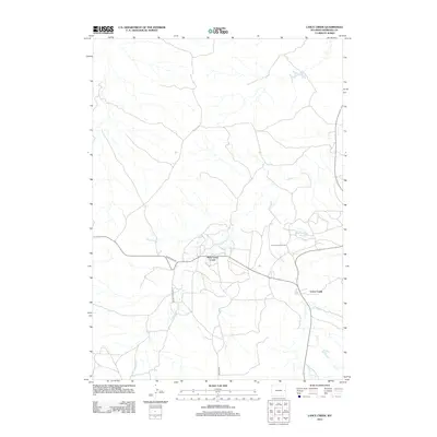
2012 Map of Lance Creek
USGS Topo · Published 2012About this map
The Lance Creek Oil Field dominates this Niobrara County landscape, illustrating the industrial infrastructure of Wyoming's energy sector. Centered around the small settlements of West Lance Creek and Lance Creek, the map details a complex network of local roads and water management features essential for oil production and ranching. Access routes like Twentymile Rd and the specifically named Carter Oil Co Rd reveal how the region's geography has been shaped by petroleum exploration and commercial transport.
Find a feature on this map
12 named features on this map. Tap any name to fly to it.
Don’t see what you’re looking for? This feature index may not catch every label — zoom into the map to look around manually.
Map Details
Editions of this 2012 Lance Creek Map
This is the sole edition of this map. No revisions or reprints were ever made.
Other maps of this area

1954 · Torrington
USGS Topo · 1:250,000

1955 · Newcastle
USGS Topo · 1:250,000

1958 · Torrington
USGS Topo · 1:250,000

1958 · Newcastle
USGS Topo · 1:250,000

1970 · Cooley Draw
USGS Topo · 1:24,000

1981 · Mercer Draw
USGS Topo · 1:24,000
1981 · Rabbit Mountains
USGS Topo · 1:24,000

1981 · Lance Creek NW
USGS Topo · 1:24,000
1981 · Funny Rock
USGS Topo · 1:24,000
1981 · Manville NE
USGS Topo · 1:24,000