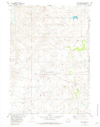
1981 Map of Lance Creek
USGS Topo · Published 1981About this map
The Lance Creek Oil Field dominates this eastern Wyoming landscape, revealing a complex network of industrial infrastructure amidst the high plains drainage systems. Centered around the settlements of West Lance Creek and Lance Creek, the map details numerous Oil Wells and Drill Holes that signal the area's economic focus in the early 1980s. A web of pipelines and access roads connects these production sites across the terrain defined by Little Lighting Creek and Twentymile Gulch. Local aviation and communication needs are evident through the inclusion of Landing Strips and a Radio Tower, while the winding course of Rusty Creek and Cherry Creek provides a natural contrast to the grid-like development of the petroleum field. The map serves as a record of the industrial footprint in Niobrara County during a period of active energy extraction.
Find a feature on this map
17 named features on this map. Tap any name to fly to it.
Don’t see what you’re looking for? This feature index may not catch every label — zoom into the map to look around manually.
Map Details
Editions of this 1981 Lance Creek Map
This is the sole edition of this map. No revisions or reprints were ever made.
Other maps of this area

1954 · Torrington
USGS Topo · 1:250,000

1955 · Newcastle
USGS Topo · 1:250,000

1958 · Torrington
USGS Topo · 1:250,000

1958 · Newcastle
USGS Topo · 1:250,000

1970 · Cooley Draw
USGS Topo · 1:24,000

1981 · Mercer Draw
USGS Topo · 1:24,000
1981 · Rabbit Mountains
USGS Topo · 1:24,000

1981 · Lance Creek NW
USGS Topo · 1:24,000
1981 · Funny Rock
USGS Topo · 1:24,000
1981 · Manville NE
USGS Topo · 1:24,000