
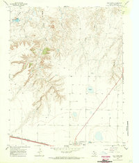
1966 Map of Landergin
USGS Topo · Published 1969About this map
Alamocitos Creek and its many branches, including the Middle Prong Alamocitos Creek and East Prong Alamocitos Creek, carve through the High Plains landscape of the Texas Panhandle. This mid-1960s survey reveals a ranching economy reliant on dispersed water sources, evidenced by several family-named landmarks like the West Prong Windmill, Chugwater Windmill, and Old Headquarters Windmill. The settlement of Landergin serves as a small rail and road hub, situated where the Chicago Rock Island and Pacific railroad parallels the southern highway.
Find a feature on this map
19 named features on this map. Tap any name to fly to it.
Don’t see what you’re looking for? This feature index may not catch every label — zoom into the map to look around manually.
Map Details
Editions of this 1966 Landergin Map
This is the sole edition of this map. No revisions or reprints were ever made.
Other maps of this area

1954 · Tucumcari
USGS Topo · 1:250,000

1958 · Tucumcari
USGS Topo · 1:250,000

1966 · Alamocitos Camp
USGS Topo · 1:24,000

1966 · Simms NW
USGS Topo · 1:24,000

1966 · Simms NE
USGS Topo · 1:24,000

1966 · Adrian
USGS Topo · 1:24,000

1966 · Big George Tank
USGS Topo · 1:24,000

1966 · Vega South
USGS Topo · 1:24,000

1966 · Torrea Peak
USGS Topo · 1:24,000
1966 · Vega North
USGS Topo · 1:24,000