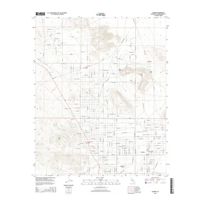
2015 Map of Landers
USGS Topo · Published 2015About this map
Landers and Homestead Valley form the residential heart of this high-desert region, situated in a landscape defined by dramatic geological formations and seasonal drainage patterns. The topography is dominated by the Mojave Desert terrain, punctuated by named peaks such as Ruby Mtn to the west and Spy Mtn to the east, while the arid expanse of Pipes Wash cuts through the valley floor. This 2015 U.S. Geological Survey representation reveals a grid of roads and trails that speak to the area's rural character, with evocative names like Ghost Rd, Mustang Trl, and Happy Trl. A network of thoroughfares, including Mikiska Blvd and University Blvd, connects the scattered desert homesteads, illustrating how modern habitation has adapted to the challenging environment surrounding the iconic Giant Rock landmark.
Find a feature on this map
93 named features on this map. Tap any name to fly to it.
Don’t see what you’re looking for? This feature index may not catch every label — zoom into the map to look around manually.
Map Details
Editions of this 2015 Landers Map
This is the sole edition of this map. No revisions or reprints were ever made.
Other maps of this area

1901 · Southern California Sheet No. 1
USGS Topo · 1:250,000

1902 · San Gorgonio
USGS Topo · 1:125,000

1904 · Southern California Sheet No. 1
USGS Topo · 1:250,000

1953 · San Bernardino
USGS Topo · 1:250,000

1954 · Hidalgo Mtn
USGS Topo · 1:24,000

1954 · Emerson Lake
USGS Topo · 1:24,000

1955 · Goat Mountain
USGS Topo · 1:24,000

1955 · Old Woman Springs
USGS Topo · 1:62,500

1955 · Emerson Lake
USGS Topo · 1:62,500

1955 · Morongo Valley
USGS Topo · 1:62,500