
1954 Map of Hidalgo Mtn
USGS Topo · Published 1955About this map
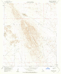
Marine Corps Training Center lands define much of this arid landscape in the Mojave Desert, where topographic relief is dominated by the prominent ridge of Hidalgo Mtn. The terrain is characterized by expansive dry lake beds, including Quackenbush Lake to the north and the eastern edge of Emerson Lake to the west. Human activity is largely represented by utilitarian desert infrastructure, such as Ames Well and several unnamed wells and mills scattered across the lower elevations. A network of Jeep Trails provides the primary means of navigation through the varying elevations, connecting the flat basins to the high point at Creole VABM 4435. This 1950s survey captures a transitional period of military land use and desert mapping just as aerial photography began to refine the representation of this isolated interior terrain.
Find a feature on this map
12 named features on this map. Tap any name to fly to it.
Don’t see what you’re looking for? This feature index may not catch every label — zoom into the map to look around manually.
Map Details
Editions of this 1954 Hidalgo Mtn Map
4 editions found
Other maps of this area

1953 · San Bernardino
USGS Topo · 1:250,000

1954 · Galway Lake
USGS Topo · 1:24,000

1954 · Emerson Lake
USGS Topo · 1:24,000

1955 · Deadman Lake NW
USGS Topo · 1:24,000

1955 · Lavic SE
USGS Topo · 1:24,000

1955 · Goat Mountain
USGS Topo · 1:24,000

1955 · Morgans Well
USGS Topo · 1:24,000

1955 · Deadman Lake SW
USGS Topo · 1:24,000

1955 · Lavic
USGS Topo · 1:62,500

1955 · Emerson Lake
USGS Topo · 1:62,500