
1955 Map of Lavic SE
USGS Topo · Published 1955About this map
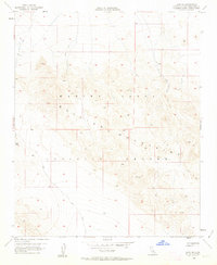
The Bullion Mountains dominate this mid-century high desert landscape, characterized by significant elevation changes and the specialized infrastructure of the Marine Corps Training Center. Established as a military training area in the California desert, the terrain is marked by remote peaks such as Round and Mesa, connected by a network of primitive transportation routes including a Jeep Trail winding through the southern reaches. The survey captures a moment when the San Bernardino County desert was increasingly utilized for strategic national defense purposes under the administration of Governor Goodwin J. Knight. Historically significant for its topography, the map highlights the geological transition at Gays Pass, reflecting the area's isolation and the stark environment that defines this portion of the Mojave Desert before more modern expansions.
Find a feature on this map
8 named features on this map. Tap any name to fly to it.
Don’t see what you’re looking for? This feature index may not catch every label — zoom into the map to look around manually.
Map Details
Editions of this 1955 Lavic SE Map
5 editions found
Other maps of this area

1953 · San Bernardino
USGS Topo · 1:250,000

1954 · Galway Lake
USGS Topo · 1:24,000

1954 · Hidalgo Mtn
USGS Topo · 1:24,000

1954 · Emerson Lake
USGS Topo · 1:24,000

1955 · Deadman Lake NW
USGS Topo · 1:24,000

1955 · Ludlow
USGS Topo · 1:24,000

1955 · Morgans Well
USGS Topo · 1:24,000

1955 · Sunshine Peak
USGS Topo · 1:24,000

1955 · Lavic Lake
USGS Topo · 1:24,000

1955 · Lavic
USGS Topo · 1:62,500