
1955 Map of Lavic Lake
USGS Topo · Published 1955About this map
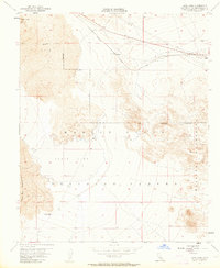
Pisgah Crater dominates the northwestern landscape of this mid-century survey, surrounded by extensive lava flows that define the local topography. The Atchison Topeka and Santa Fe railroad cuts across the northern desert, serving the small siding at Lavic and the station at Argos. These rail points provided essential access for regional industry, including operations at the Gravel Pit and the remote Kenton Mill located south of the Lava Bed Mountains. Much of the territory is marked by the Marine Corps Training Center and the Naval Reservation Boundary, reflecting the increasing military presence in the High Desert during the 1950s. The dry expanse of Lavic Lake sits at the center of the sheet, framed by the heights of the Bullion Mountains. Traces of early aviation and infrastructure are visible via the Airway Beacon, a Landing Field, and a long-distance Pipe Line.
Find a feature on this map
18 named features on this map. Tap any name to fly to it.
Don’t see what you’re looking for? This feature index may not catch every label — zoom into the map to look around manually.
Map Details
Editions of this 1955 Lavic Lake Map
3 editions found
Other maps of this area

1953 · San Bernardino
USGS Topo · 1:250,000

1954 · Galway Lake
USGS Topo · 1:24,000

1955 · Ludlow
USGS Topo · 1:24,000

1955 · Lavic SE
USGS Topo · 1:24,000

1955 · Morgans Well
USGS Topo · 1:24,000

1955 · Sunshine Peak
USGS Topo · 1:24,000

1955 · Lavic
USGS Topo · 1:62,500

1955 · Cady Mountains
USGS Topo · 1:62,500

1955 · Broadwell Lake
USGS Topo · 1:62,500

1955 · Ludlow
USGS Topo · 1:62,500