
1955 Map of Ludlow
USGS Topo · Published 1956About this map
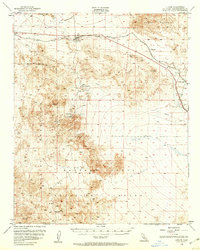
Ludlow serves as the central hub of this mid-century desert landscape, situated at the junction of the Atchison Topeka and Santa Fe railroad and the iconic U. S. Route 66. The map captures a transition in desert activity, showing the path of an Old Railroad Grade north of the main line and several Pipeline corridors cutting across the arid terrain. To the south, the industrial imprint of mining is evident around Stedman, where the Bagdad Chase Mine and numerous shafts dot the foothills of the Bullion Mountains. Large-scale land use is dominated by military designations, including a portion of the Naval Reservation Boundary and the expansive Marine Corps Training Center. From the Cem near Argos to the Airway Beacon on Swede Hill, the map documents the infrastructure required to navigate and inhabit this portion of the Mojave during the 1950s.
Find a feature on this map
30 named features on this map. Tap any name to fly to it.
Don’t see what you’re looking for? This feature index may not catch every label — zoom into the map to look around manually.
Map Details
Editions of this 1955 Ludlow Map
2 editions found
Other maps of this area

1942 · Amboy
USGS Topo · 1:250,000

1943 · Amboy
USGS Topo · 1:250,000

1953 · San Bernardino
USGS Topo · 1:250,000

1954 · Needles
USGS Topo · 1:250,000

1954 · Hidalgo Mtn
USGS Topo · 1:24,000

1954 · Bagdad SW
USGS Topo · 1:24,000

1954 · Ludlow SE
USGS Topo · 1:24,000

1955 · Deadman Lake NW
USGS Topo · 1:24,000

1955 · Ludlow
USGS Topo · 1:24,000

1955 · Lavic SE
USGS Topo · 1:24,000