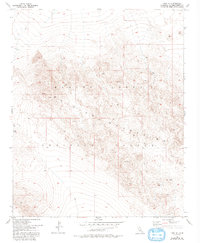
1955 Map of Lavic SE
USGS Topo · Published 1993About this map
The Bullion Mountains dominate this high desert landscape, characterized by ancient volcanic activity and restricted military access. Extensive Lava flows define the northern terrain, leading into the jagged ridges of the Marine Corps Training Center. The mapping reflects a specialized geography where natural landmarks like Gays Pass and the elevated Mesa provided the primary orientation for those navigating the arid San Bernardino County interior. This 1955 survey, updated through the early 1990s, documents a region largely untouched by residential development, instead dedicated to tactical training. Primitive transport is limited to a few 4wd tracks that wind through the peaks, including the notable high point at Round, illustrating the isolation of this sector of the Mojave Desert before modern infrastructure could alter its character.
Find a feature on this map
8 named features on this map. Tap any name to fly to it.
Don’t see what you’re looking for? This feature index may not catch every label — zoom into the map to look around manually.
Map Details
Editions of this 1955 Lavic SE Map
5 editions found
Other maps of this area

1953 · San Bernardino
USGS Topo · 1:250,000

1954 · Galway Lake
USGS Topo · 1:24,000

1954 · Hidalgo Mtn
USGS Topo · 1:24,000

1954 · Emerson Lake
USGS Topo · 1:24,000

1955 · Deadman Lake NW
USGS Topo · 1:24,000

1955 · Ludlow
USGS Topo · 1:24,000

1955 · Lavic SE
USGS Topo · 1:24,000

1955 · Morgans Well
USGS Topo · 1:24,000

1955 · Sunshine Peak
USGS Topo · 1:24,000

1955 · Lavic Lake
USGS Topo · 1:24,000