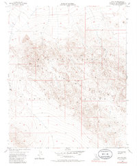
1955 Map of Lavic SE
USGS Topo · Published 1986About this map
The Bullion Mountains dominate this high-desert landscape within the boundaries of the Marine Corps Training Center. Mapped during the mid-1950s, the terrain is defined by dramatic volcanic features and remote passes. A significant area of Lava flows is visible in the northern section, contrasting with the steep ridgelines that rise toward peaks like Vabm 4699. The survey reveals a sparsely developed region where movement was restricted to primitive Trail networks and a rugged Jeep Trail system. Significant landmarks such as Gays Pass and the elevated plateau of the Mesa provided the primary navigation points for those traversing this military training ground. This sheet preserves the primitive state of the Mojave interior before more modern infrastructure or changes to the training center boundaries.
Find a feature on this map
11 named features on this map. Tap any name to fly to it.
Don’t see what you’re looking for? This feature index may not catch every label — zoom into the map to look around manually.
Map Details
Editions of this 1955 Lavic SE Map
5 editions found
Other maps of this area

1953 · San Bernardino
USGS Topo · 1:250,000

1954 · Galway Lake
USGS Topo · 1:24,000

1954 · Hidalgo Mtn
USGS Topo · 1:24,000

1954 · Emerson Lake
USGS Topo · 1:24,000

1955 · Deadman Lake NW
USGS Topo · 1:24,000

1955 · Ludlow
USGS Topo · 1:24,000

1955 · Lavic SE
USGS Topo · 1:24,000

1955 · Morgans Well
USGS Topo · 1:24,000

1955 · Sunshine Peak
USGS Topo · 1:24,000

1955 · Lavic Lake
USGS Topo · 1:24,000