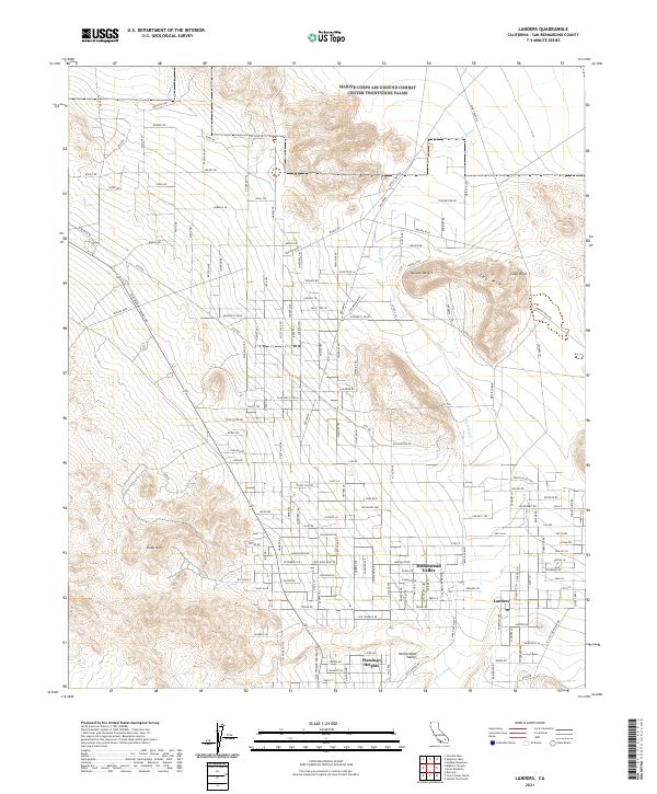
2021 Map of Landers
USGS Topo · Published 2021About this map
Homestead Valley and Flamingo Heights characterize this high desert landscape within the Mojave Desert as it appeared in the early 2020s. The map illustrates a grid of residential and connector roads, such as Old Woman Springs Rd and Wright Blvd, that tie these remote settlements together. To the north, the boundary of the Marine Corps Air Ground Combat Center Twentynine Palms marks the transition from civilian development to military jurisdiction. Distinctive topographical features like Spy Mtn, Ruby Mtn, and the iconic Giant Rock emerge from the desert floor, while the winding path of Pipes Wash provides a natural drainage route through the arid terrain. Local-history researchers can trace the extensive network of smaller named ways, including Creole Mine Rd and Mikiska Blvd, which speak to the area's development and land use patterns.
Find a feature on this map
155 named features on this map. Tap any name to fly to it.
Don’t see what you’re looking for? This feature index may not catch every label — zoom into the map to look around manually.
Map Details
Editions of this 2021 Landers Map
This is the sole edition of this map. No revisions or reprints were ever made.
Other maps of this area

1901 · Southern California Sheet No. 1
USGS Topo · 1:250,000

1902 · San Gorgonio
USGS Topo · 1:125,000

1904 · Southern California Sheet No. 1
USGS Topo · 1:250,000

1953 · San Bernardino
USGS Topo · 1:250,000

1954 · Hidalgo Mtn
USGS Topo · 1:24,000

1954 · Emerson Lake
USGS Topo · 1:24,000

1955 · Goat Mountain
USGS Topo · 1:24,000

1955 · Old Woman Springs
USGS Topo · 1:62,500

1955 · Emerson Lake
USGS Topo · 1:62,500

1955 · Morongo Valley
USGS Topo · 1:62,500