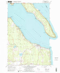
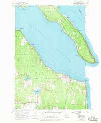
1956 Map of Langley
USGS Topo · Published 1984About this map
Whidbey Island and Camano Island face each other across the deep waters of Saratoga Passage, defining the maritime character of this Puget Sound corridor. The waterfront community of Langley serves as a primary anchor on the southern shore, characterized by its grid of streets overlooking the passage. Small beach settlements such as Mabana, Sunny Shore Acres, and Tillicum Beach dot the coastline of Camano Island, while the western side of the channel is marked by Bells Beach and the community of Saratoga.
Find a feature on this map
44 named features on this map. Tap any name to fly to it.
Don’t see what you’re looking for? This feature index may not catch every label — zoom into the map to look around manually.
Map Details
Editions of this 1956 Langley Map
2 editions found
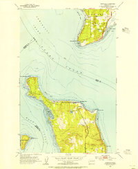
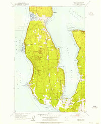
Other maps of this area

1895 · Snohomish
USGS Topo · 1:125,000

1897 · Seattle
USGS Topo · 1:125,000

1911 · Mount Vernon
USGS Topo · 1:125,000

1937 · Port Gamble
USGS Topo · 1:62,500

1939 · Coupeville
USGS Topo · 1:62,500

1940 · Port Gamble
USGS Topo · 1:62,500

1942 · Edmonds
USGS Topo · 1:62,500

1943 · Stanwood
USGS Topo · 1:62,500
1953 · Hansville
USGS Topo · 1:24,000
1953 · Freeland
USGS Topo · 1:24,000