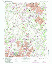
1966 Map of Lansdale
USGS Topo · Published 1983About this map
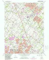
Norristown State Hospital anchors the southern landscape of this Montgomery County survey, a massive institutional footprint situated just north of the Septa rail lines. The map reveals the postwar suburban expansion through central Pennsylvania, where established borough centers like Lansdale and North Wales begin to bleed into once-distinct villages such as Kulpsville and West Point. This growth is clearly tracked by the 1980s purple-tinted urban extensions, illustrating the infill between historic crossroads.
Find a feature on this map
98 named features on this map. Tap any name to fly to it.
Don’t see what you’re looking for? This feature index may not catch every label — zoom into the map to look around manually.
Map Details
Editions of this 1966 Lansdale Map
5 editions found
Other maps of this area

1888 · Quakertown
USGS Topo · 1:62,500

1890 · Doylestown
USGS Topo · 1:62,500

1890 · Quakertown
USGS Topo · 1:62,500

1891 · Doylestown
USGS Topo · 1:62,500

1893 · Germantown
USGS Topo · 1:62,500

1894 · Quakertown
USGS Topo · 1:62,500

1894 · Norristown
USGS Topo · 1:62,500

1894 · Germantown
USGS Topo · 1:62,500

1895 · Norristown
USGS Topo · 1:62,500

1896 · Germantown
USGS Topo · 1:62,500