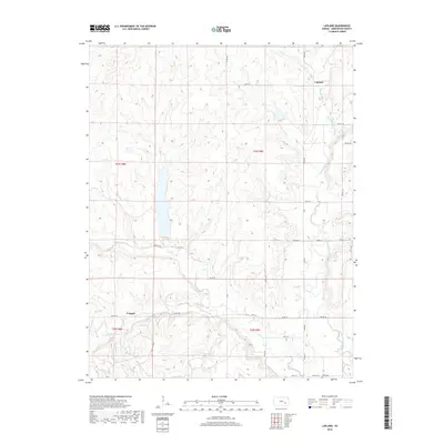
2018 Map of Lapland
USGS Topo · Published 2018About this map
Lapland and Ivanpah anchor this section of Greenwood County, where the headwaters of the Fall River system begin to carve into the Kansas landscape. The geography is defined by the convergence of several significant drainage branches, including the West Branch Fall River and the East Branch Fall River, which create a complex network of ridges and draws. These waterways dictate the local infrastructure, with rural routes like River Rd and Twp Rd 38 following the natural contours of the valley floors. For those tracing regional history, the presence of Ladd Cem near the southern boundary provides a specific point of reference for early settlement patterns. The map clearly illustrates how the township and range system overlay this undulating terrain, with small drainages such as Ivanpah Cr and Oleson Cr threading through the rural sections.
Find a feature on this map
35 named features on this map. Tap any name to fly to it.
Don’t see what you’re looking for? This feature index may not catch every label — zoom into the map to look around manually.
Map Details
Editions of this 2018 Lapland Map
This is the sole edition of this map. No revisions or reprints were ever made.
Other maps of this area

1885 · Eureka
USGS Topo · 1:125,000

1888 · Emporia
USGS Topo · 1:125,000

1888 · Eureka
USGS Topo · 1:125,000

1888 · Eldorado
USGS Topo · 1:125,000

1894 · Emporia
USGS Topo · 1:125,000

1894 · Eureka
USGS Topo · 1:125,000

1898 · Cottonwood Falls
USGS Topo · 1:125,000

1955 · Wichita
USGS Topo · 1:250,000

1955 · Hutchinson
USGS Topo · 1:250,000

1958 · Wichita
USGS Topo · 1:250,000