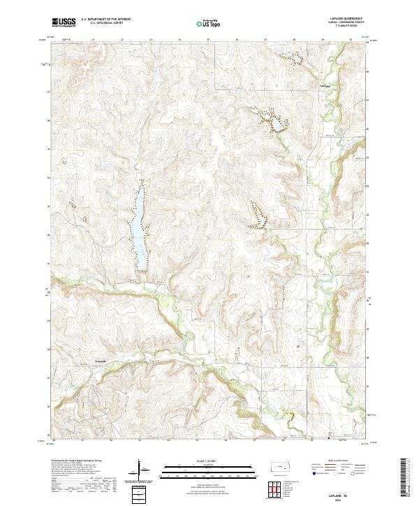
2022 Map of Lapland
USGS Topo · Published 2022About this map
Lapland and Ivanpah anchor this section of Greenwood County, where the headwaters of the Fall River system define the landscape. The geography is dominated by the convergence of several major tributaries, including the East Branch Fall River and the West Branch Fall River, which create a network of drainages across the terrain. These watercourses are supported by smaller feeders like Oleson Cr and Ivanpah Cr, illustrating the hydrological importance of this area to the broader watershed.
Find a feature on this map
35 named features on this map. Tap any name to fly to it.
Don’t see what you’re looking for? This feature index may not catch every label — zoom into the map to look around manually.
Map Details
Editions of this 2022 Lapland Map
This is the sole edition of this map. No revisions or reprints were ever made.
Other maps of this area

1885 · Eureka
USGS Topo · 1:125,000

1888 · Emporia
USGS Topo · 1:125,000

1888 · Eureka
USGS Topo · 1:125,000

1888 · Eldorado
USGS Topo · 1:125,000

1894 · Emporia
USGS Topo · 1:125,000

1894 · Eureka
USGS Topo · 1:125,000

1898 · Cottonwood Falls
USGS Topo · 1:125,000

1955 · Wichita
USGS Topo · 1:250,000

1955 · Hutchinson
USGS Topo · 1:250,000

1958 · Wichita
USGS Topo · 1:250,000