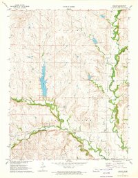
1971 Map of Lapland
USGS Topo · Published 1973About this map
Fall River meanders through the heart of Greenwood County, defining the agricultural and industrial character of the townships of Salem and South Salem in the early 1970s. The landscape is a patchwork of rural interests, where traditional homesteading is evidenced by the Upper Fall River Ch & Cem and Ladd Cem, juxtaposed against an active petroleum economy. Multiple extraction sites, including the Wilkerson Oil Field and Teichgraber Oil Field, are scattered across the terrain.
Find a feature on this map
21 named features on this map. Tap any name to fly to it.
Don’t see what you’re looking for? This feature index may not catch every label — zoom into the map to look around manually.
Map Details
Editions of this 1971 Lapland Map
This is the sole edition of this map. No revisions or reprints were ever made.
Other maps of this area

1885 · Eureka
USGS Topo · 1:125,000

1888 · Emporia
USGS Topo · 1:125,000

1888 · Eureka
USGS Topo · 1:125,000

1888 · Eldorado
USGS Topo · 1:125,000

1894 · Emporia
USGS Topo · 1:125,000

1894 · Eureka
USGS Topo · 1:125,000

1898 · Cottonwood Falls
USGS Topo · 1:125,000

1955 · Wichita
USGS Topo · 1:250,000

1955 · Hutchinson
USGS Topo · 1:250,000

1958 · Wichita
USGS Topo · 1:250,000