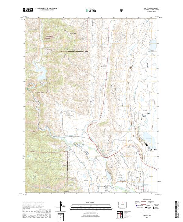
2022 Map of Laporte
USGS Topo · Published 2022About this map
Laporte and Bellvue serve as the primary gateways to the mountain front where the Cache la Poudre River emerges into the Colorado foothills. The 2022 landscape is defined by an intricate network of irrigation systems, including the Poudre Valley Canal, Charles Hansen Canal, and the Little Cache la Poudre Ditch, which redirect water across the terrain to support local agriculture. This hydrology is backdropped by the steep elevations of Bonner Peak and the southern reaches of the Roosevelt National Forest.
Find a feature on this map
76 named features on this map. Tap any name to fly to it.
Don’t see what you’re looking for? This feature index may not catch every label — zoom into the map to look around manually.
Map Details
Editions of this 2022 Laporte Map
This is the sole edition of this map. No revisions or reprints were ever made.
Other maps of this area

1906 · Fort Collins
USGS Topo · 1:62,500

1907 · Livermore
USGS Topo · 1:125,000

1908 · Fort Collins
USGS Topo · 1:62,500

1909 · Livermore
USGS Topo · 1:125,000

1954 · Greeley
USGS Topo · 1:250,000

1957 · Greeley
USGS Topo · 1:250,000

1958 · Greeley
USGS Topo · 1:250,000

1960 · Livermore
USGS Topo · 1:24,000
1960 · Fort Collins
USGS Topo · 1:24,000
1960 · Buckeye
USGS Topo · 1:24,000