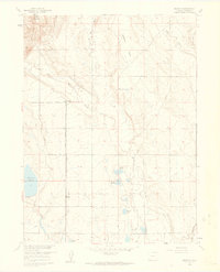
1960 Map of Buckeye
USGS Topo · Published 1962About this map
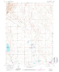
Rawhide Flats and the high point of Gilman Mountain characterize this high plains landscape during the early 1960s. The settlement at Buckeye serves as a focal point for a complex irrigation network, including the Park Creek Lateral and the North Poudre Ditch, which redirect water through this arid terrain. This water management system is further evidenced by a series of reservoirs such as Boxelder Res No 1 and Reservoir No 15. Evidence of former transportation infrastructure appears in the form of an Old Railroad Grade passing through Ripple, suggesting a shift in the local transit and shipping economy. Near the southern edge, the Wellington Field and features like Bubbles Lake and Caverly Lake illustrate the specific hydrological and industrial modifications made to the Larimer County landscape to support regional development.
Find a feature on this map
21 named features on this map. Tap any name to fly to it.
Don’t see what you’re looking for? This feature index may not catch every label — zoom into the map to look around manually.
Map Details
Editions of this 1960 Buckeye Map
5 editions found
Other maps of this area

1906 · Fort Collins
USGS Topo · 1:62,500

1907 · Livermore
USGS Topo · 1:125,000

1908 · Fort Collins
USGS Topo · 1:62,500

1908 · Eaton
USGS Topo · 1:125,000

1909 · Livermore
USGS Topo · 1:125,000

1910 · Eaton
USGS Topo · 1:125,000

1954 · Greeley
USGS Topo · 1:250,000

1957 · Greeley
USGS Topo · 1:250,000

1958 · Greeley
USGS Topo · 1:250,000

1960 · Livermore
USGS Topo · 1:24,000