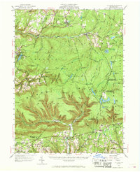
1953 Map of LaPorte
USGS Topo · Published 1968About this map
Loyalsock Creek winds through the heart of Sullivan County, anchoring a landscape where mountain ridges and deep hollows define the pattern of settlement. This 1953 revision of 1931 surveys details the county seat of Laporte and surrounding villages such as Mildred, Bernice, and Lopez. To the southeast, the terrain transitions into the high elevations of Ricketts Mountain and the water-rich expanses of Ricketts Glen State Park, including Ganoga Lake and Lake Rose.
Find a feature on this map
136 named features on this map. Tap any name to fly to it.
Don’t see what you’re looking for? This feature index may not catch every label — zoom into the map to look around manually.
Map Details
Editions of this 1953 LaPorte Map

Other maps of this area

1891 · Harveys Lake
USGS Topo · 1:62,500

1893 · Harvey Lake
USGS Topo · 1:62,500

1894 · Shickshinny
USGS Topo · 1:62,500

1894 · Bloomsburg
USGS Topo · 1:62,500

1927 · Eagles Mere
USGS Topo · 1:48,000

1932 · Eagle Mere
USGS Topo · 1:62,500

1934 · Laporte
USGS Topo · 1:62,500

1935 · Hughesville
USGS Topo · 1:62,500

1943 · Monroeton
USGS Topo · 1:62,500

1943 · Powell
USGS Topo · 1:62,500