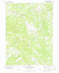
1977 Map of Larabee Valley
USGS Topo · Published 1978About this map
Larabee Valley and the surrounding Humboldt County highlands are defined by a network of ranching homesteads and remote mountain ridges in this late 1970s record. The landscape is dotted with family-named outposts such as Cottrell Ranch, Gunlock Ranch, and Brightman Ranch, alongside specialized operations like the Snowline Fox Farm. Educational history is anchored at the Buck Mtn Sch near McClellan Mtn, while the Indian Cabin (Site) near Larabee Buttes points to even earlier layers of human habitation.
Find a feature on this map
46 named features on this map. Tap any name to fly to it.
Don’t see what you’re looking for? This feature index may not catch every label — zoom into the map to look around manually.
Map Details
Editions of this 1977 Larabee Valley Map
This is the sole edition of this map. No revisions or reprints were ever made.
Other maps of this area

1914 · Pilot Creek
USGS Topo · 1:62,500

1915 · Big Bar and Vicinity
USGS Topo · 1:250,000

1921 · Dyerville
USGS Topo · 1:62,500

1922 · Kneeland
USGS Topo · 1:62,500

1949 · Blocksburg
USGS Topo · 1:62,500

1949 · Weott
USGS Topo · 1:62,500

1950 · Iaqua Buttes
USGS Topo · 1:62,500

1951 · Weott
USGS Topo · 1:62,500

1951 · Blocksburg
USGS Topo · 1:62,500

1951 · Pilot Creek
USGS Topo · 1:62,500