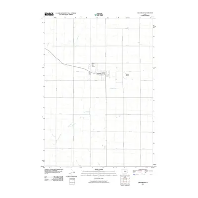
2010 Map of Larchwood
USGS Topo · Published 2010About this map
Larchwood serves as the central hub of this Lyon County agricultural landscape, situated at the intersection of a vast grid of local roads and the regional highway corridor. The town's civic life is centered around the Larchwood Post Office, while its long-standing community history is preserved at the Saint Marys Cemetery and Larchwood Cemetery located just to the northwest. Beyond the residential streets, the terrain is defined by the drainage patterns of Blood Run and the meandering Klondike Creek, which carve through the productive fields of Larchwood Township. The presence of Zangger Airport to the east of town highlights the area's modern infrastructure and connection to regional aviation, illustrating the blend of traditional farming roots and contemporary utility in this corner of Iowa.
Find a feature on this map
24 named features on this map. Tap any name to fly to it.
Don’t see what you’re looking for? This feature index may not catch every label — zoom into the map to look around manually.
Map Details
Editions of this 2010 Larchwood Map
This is the sole edition of this map. No revisions or reprints were ever made.
Other maps of this area

1897 · Canton
USGS Topo · 1:125,000

1900 · Canton
USGS Topo · 1:125,000

1955 · Sioux Falls
USGS Topo · 1:250,000

1958 · Sioux Falls
USGS Topo · 1:250,000

1962 · Klondike
USGS Topo · 1:24,000

1962 · Canton
USGS Topo · 1:24,000

1962 · Brandon
USGS Topo · 1:24,000

1967 · Valley Springs
USGS Topo · 1:24,000

1967 · Hills
USGS Topo · 1:24,000

1971 · Lester
USGS Topo · 1:24,000