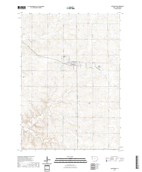
2022 Map of Larchwood
USGS Topo · Published 2022About this map
Larchwood serves as the central hub of this Northwest Iowa landscape, where a grid of rural section roads meets the winding courses of Blood Run and Klondike Cr. The town's local history is anchored by the Larchwood Cem and Saint Marys Cem, located just north of the main residential streets. The mapping of the township boundaries t100n r48w and t99n r47w reveals a classic midwestern agricultural pattern, punctuated by specialized features like the Zangger Vintage Airpark to the east. Towards the southern edge of the quadrangle, the Lake Pahoja Trl indicates a transition toward recreational land use near the county border. The drainage patterns of the creeks flowing through these sections illustrate the subtle topography that has dictated farmstead placement and road development in Lyon County for generations.
Find a feature on this map
41 named features on this map. Tap any name to fly to it.
Don’t see what you’re looking for? This feature index may not catch every label — zoom into the map to look around manually.
Map Details
Editions of this 2022 Larchwood Map
This is the sole edition of this map. No revisions or reprints were ever made.
Other maps of this area

1897 · Canton
USGS Topo · 1:125,000

1900 · Canton
USGS Topo · 1:125,000

1955 · Sioux Falls
USGS Topo · 1:250,000

1958 · Sioux Falls
USGS Topo · 1:250,000

1962 · Klondike
USGS Topo · 1:24,000

1962 · Canton
USGS Topo · 1:24,000

1962 · Brandon
USGS Topo · 1:24,000

1967 · Valley Springs
USGS Topo · 1:24,000

1967 · Hills
USGS Topo · 1:24,000

1971 · Lester
USGS Topo · 1:24,000