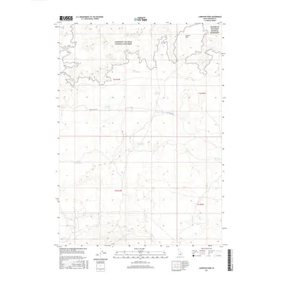
2017 Map of Larkspur Park
USGS Topo · Published 2017About this map
Craters of the Moon National Monument dominates the northern landscape of this Minidoka County region, showcasing the distinctive volcanic terrain of southern Idaho. The area is defined by a sophisticated network of water management features, reflecting the critical role of irrigation and livestock watering in this arid environment. Named catchments such as Mike Reservoir, Mabel Reservoir, and Bunting Reservoir are scattered across the high desert, often following township and range lines. The transition from the rugged monument lands into the park-like flats of Larkspur Park is navigated by Bear Trap Cave Rd, which provides one of the few established routes through this remote interior. Small natural basins and man-made pools like School Section Lake and Section Line Reservoir further illustrate the systematic division and utilization of the public land survey system.
Find a feature on this map
16 named features on this map. Tap any name to fly to it.
Don’t see what you’re looking for? This feature index may not catch every label — zoom into the map to look around manually.
Map Details
Editions of this 2017 Larkspur Park Map
This is the sole edition of this map. No revisions or reprints were ever made.
Other maps of this area

1954 · Pocatello
USGS Topo · 1:250,000

1955 · Idaho Falls
USGS Topo · 1:250,000

1958 · Idaho Falls
USGS Topo · 1:250,000

1958 · Pocatello
USGS Topo · 1:250,000

1972 · Bear Park SW
USGS Topo · 1:24,000

1972 · Community Lake
USGS Topo · 1:24,000

1972 · Minidoka
USGS Topo · 1:24,000

1972 · Max
USGS Topo · 1:24,000

1972 · Laidlaw Lake
USGS Topo · 1:24,000

1972 · Bottleneck Lake
USGS Topo · 1:24,000