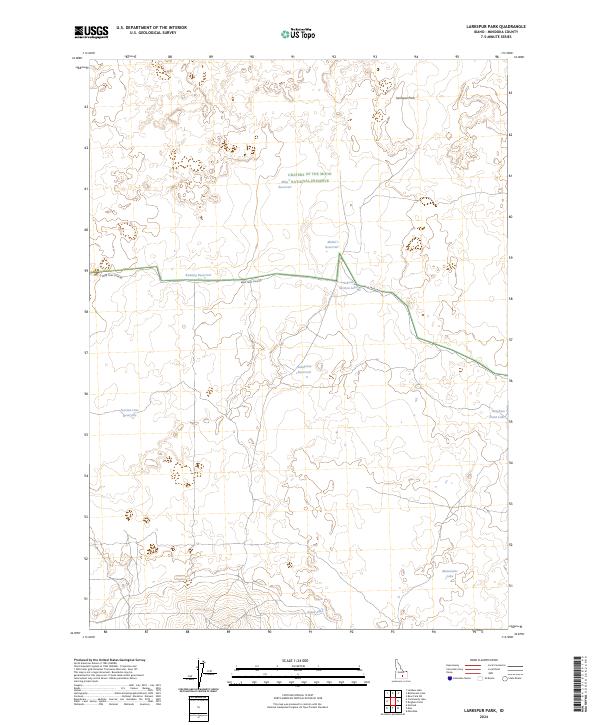
2024 Map of Larkspur Park
USGS Topo · Published 2024About this map
Craters of the Moon National Preserve encompasses a significant portion of this high-desert Idaho landscape, where the volcanic geology is punctuated by numerous named catchments and reservoirs. The area is defined by its isolation and the necessity of water management, evidenced by features like Mike Reservoir, Mabel Reservoir, and Bunting Reservoir scattered across the township lines. A single primary artery, Bear Trap Cave Rd, provides access through the northern half of the quadrangle, passing just south of Larkspur Park.
Find a feature on this map
16 named features on this map. Tap any name to fly to it.
Don’t see what you’re looking for? This feature index may not catch every label — zoom into the map to look around manually.
Map Details
Editions of this 2024 Larkspur Park Map
This is the sole edition of this map. No revisions or reprints were ever made.
Other maps of this area

1954 · Pocatello
USGS Topo · 1:250,000

1955 · Idaho Falls
USGS Topo · 1:250,000

1958 · Idaho Falls
USGS Topo · 1:250,000

1958 · Pocatello
USGS Topo · 1:250,000

1972 · Bear Park SW
USGS Topo · 1:24,000

1972 · Community Lake
USGS Topo · 1:24,000

1972 · Minidoka
USGS Topo · 1:24,000

1972 · Max
USGS Topo · 1:24,000

1972 · Laidlaw Lake
USGS Topo · 1:24,000

1972 · Bottleneck Lake
USGS Topo · 1:24,000